KGeoTag
Категории: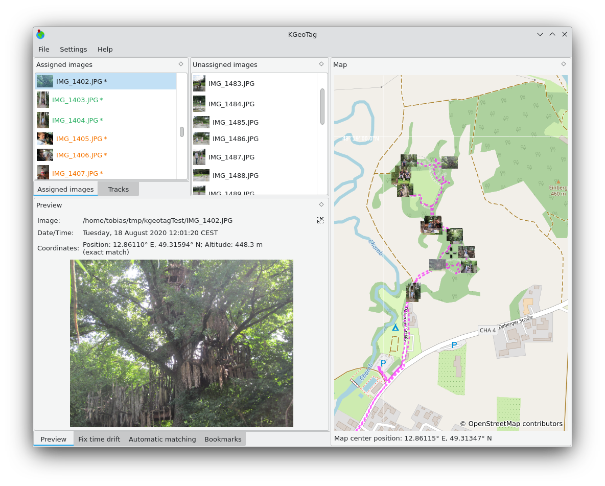
KGeoTag — это автономное приложение для геопривязки. Географические координаты могут быть связаны с изображениями несколькими способами: либо путём сопоставления с геоданными в формате GPX, либо вручную — перетаскиванием на карту, с помощью закладок или непосредственным вводом значений. Координаты могут сохраняться в заголовке Exif изображений и/или в файлах XMP.

Установить на
Linux

Выпуски RSS
2.0.0
2026-03-13
1.8.0
2025-03-09
1.7.0
2024-12-07
1.6.0
2024-10-03
1.5.0
2024-01-02
1.4.0
2023-01-28
1.3.1
2022-09-05
1.2.0
2021-11-12
1.1.0
2021-10-19
1.0.0
2021-03-06